
Many of the joys of hiking are small surprises: brightly coloured fungi; a dramatically curved tree; food tasting so much better outside; a group of seven flame robins around the fireplace on a grey morning. Then there are wonders that are spectacular but not unexpected: views from a mountaintop, night skies, sunrises.
Then once in a while there is something utterly unexpected and breathtaking.
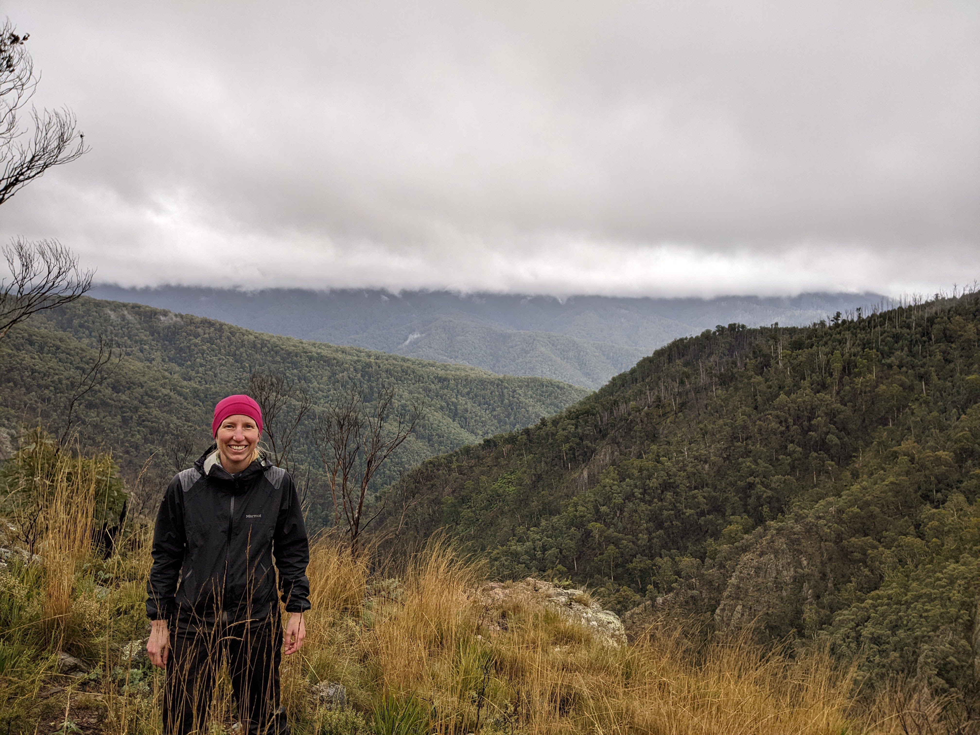
Day 3 is meant to be a quiet day: we spend the morning sheltering out of the rain at Tin Mine Huts. We finish reading the newspaper that we’d brought along for kindling, and Rachel does the crossword. After lunch the rain eases, and we decide we’d better make the most of the afternoon, cold and grey as it is. So with raincoats, safety gear and muesli bars, we set off back up the track to see if we can find Tin Mine Falls. Our expectations aren’t high – we might not find the track, or might not get as far as the falls.

Following the instructions in the Australian Alps Walking Track book (5th ed., 2021), we locate a suggestion of a track leading west from Cascade Trail 2.7km north of the huts. The first suggestion was a false start; the second much clearer, leading into fairly dense bush. We spot flagging tape at intervals – someone has made this walk much easier by flagging trees along the way. These lead us down a steep descent to where a fallen branch provides a bridge of sorts across the narrow but fast-flowing Tin Mine Creek creek.
We bush-bash up the other side, among ash trunks glistening cream and pink in the rain, and onto a ridge where the vegetation grows drier and the ground is rocky. Here there are thickets of burnt saplings, and we lose the trail for a while. We plunge into the head of a densely vegetated gully, still heading west, before re-locating the flags and turning right, walking around the side of a steep hill. The walk is beautiful, but at times a little unnerving – despite knowing how to navigate, carrying maps and a compass and with a GPS tracking our route, and despite the flags. Walking off track is a rare experience for me – last time was in the Boranup Forest near Margaret River – and it carries with it a new sense of vulnerability to the enormity of the landscape.
We know that in theory we should emerge on a ridge from where we can see the falls. We come through thinning trees on a grassy spur, and as the ground begins to fall away, suddenly the view is before us.

A deep, steep valley, surrounded by rugged mountain ranges half-hidden in rain and cloud. It is dramatic and breathtaking – helped by the gloom of the weather and our sense of exposure on a rocky outcrop in the wind, with this incredible drop beneath us.
We can hear the falls over the wind before we see them – they are tucked away to our right far below. Although they drop 120m, pouring out of a valley we can’t see and plunging down among the rocks and trees, they are dwarfed by the mountains all around them. It’s hard to believe those falls are from the same creek we climbed across earlier. In many places the trunks of the trees are clearly visible on the mountain sides opposite – so steep are the slopes that there is no opportunity for a dense canopy here. Higher up, the silver skeletons of long-burnt trees tower over the canopy of younger ash.

Later, I read an account by John Blay, naturalist, walker and writer. Approaching from another angle, he writes:
A lyrebird scrambles away in alpine ash. Then suddenly there is the edge, a gut-wrenching view down into the Murray River, like a hole at my feet. The clouds lift as I cut around the clifftops above the remarkable canyon of the Tin Mine Creek. Rock faces show where shale has been sheared to a depth of hundreds of metres. Some great distance below me the falls begin their drop of a clear 120 metres in veils of droplets and shifting rainbows to rainforest far below. This one vision says so much about where I am, what a perilous plateau I’ve attained and how far down it is to go back to the reality of the lowlands. Spiderflowers pepper the slopes with crimson dots. Stepping lightly on the way back I find parsons band orchids and rose quartz. The stone underfoot is often coloured with the glint of minerals. The silvery blue leaf forms of spinning gum excite me.
John Blay, On Track: Searching out the Bundian Way (2015)
I hadn’t comprehended, when we stood there above the falls, that we were looking at a fall into the Murray River. From its beginnings to the south at Cowombat Flat (which I’m yet to visit), it’s hard to comprehend the dramatic curve of the river that brings it back to so near here, flowing north towards the great ranges that rise ahead, yet already moving down, beginning its long, interrupted pathway towards the slopes and plains to the west.
And Blay’s words stick with me: what a perilous plateau I’ve attained and how far down it is to go back to the reality of the lowlands. We are here in the mountains so briefly, R and I. Rather than perilous, it feels unreal, but there is no doubting how very far away the lowlands are.
I look back one last time before we walk away, into this dramatic distance.

Next: The Pilot

As a boy growing up in the British Columbia mountains, seeking trails, spring ponds and the vistas of the valleys, I can relate to the words of this blog, the images and the sense of wilderness. Thanks for writing about the mountains, helping me to remember the sounds and sights. Thanks also for the smiling faces of two ‘happy campers’.