The Pilot (The Pilot and the Pinch Part III)

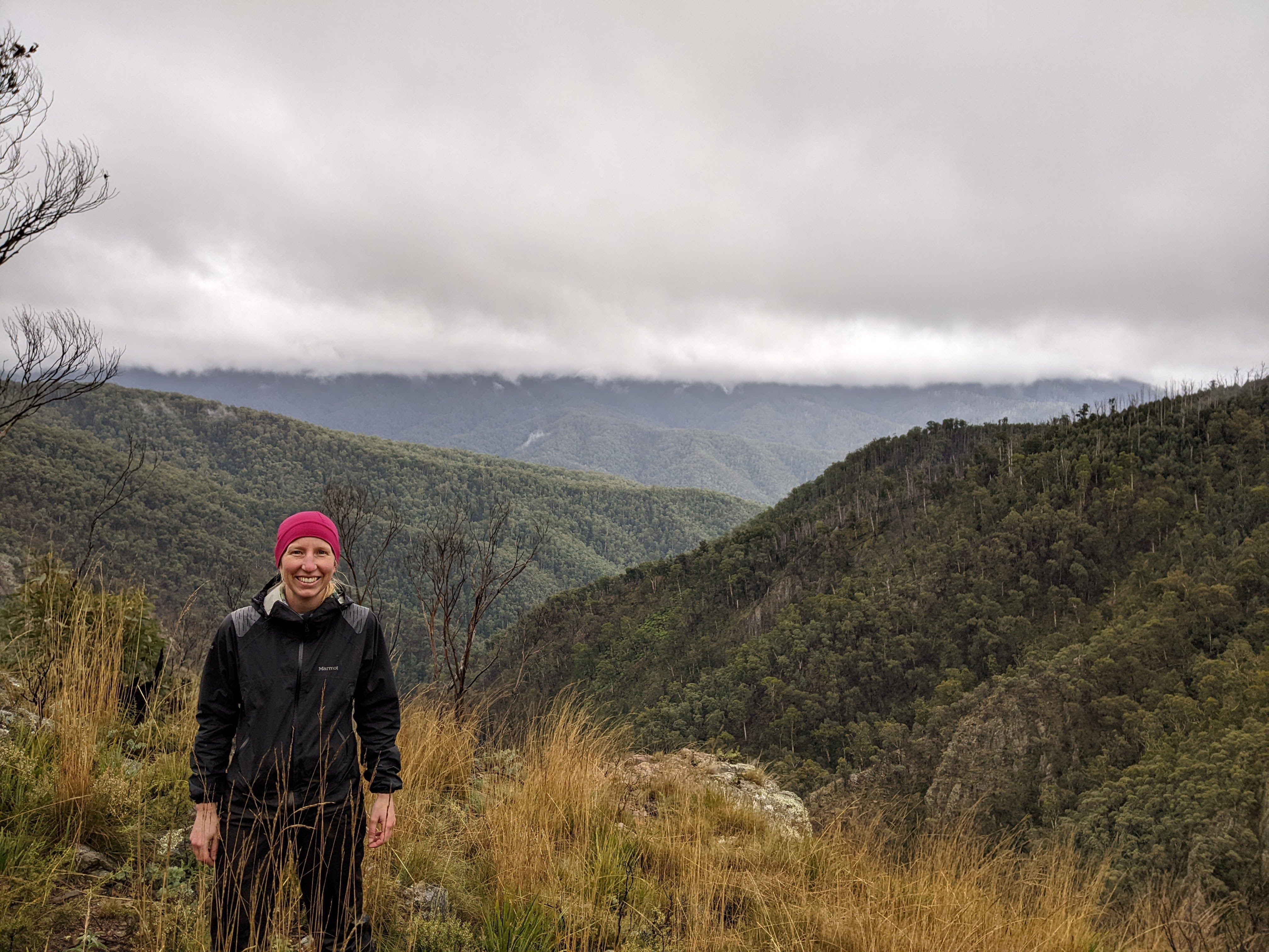
After all the rain and cloud, climbing the Pilot was an uncertain proposition as far as views went. R was keen – she’d hiked past it a few times but for various reasons not had time to climb it. I was less enthusiastic: the area was all new for me and my lazy side wasn’t keen on a 340m climb.

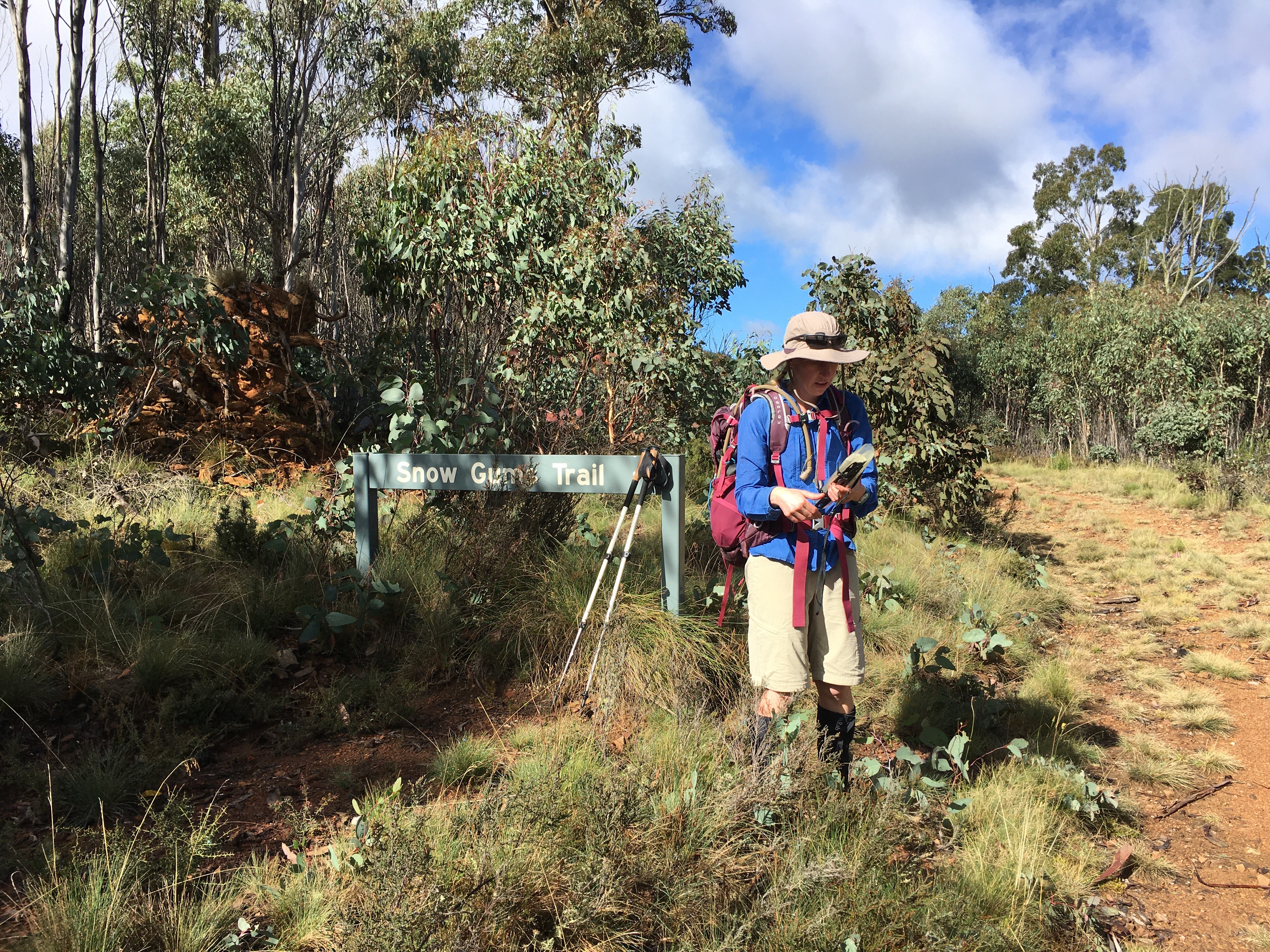
It was a lovely morning’s walk (7.5km carrying very little gear) from Tin Mine Huts to the junction of Cowombat and Snow Gum Trails, the sky clearing as we went. If we were heading to Cowombat Flat we’d have turned right at the junction; instead we went straight on for half a kilometre looking for any sign of a track. There wasn’t one that we could see, and we struck off up the slope.

The skies clear in time for us to hike up The Pilot.

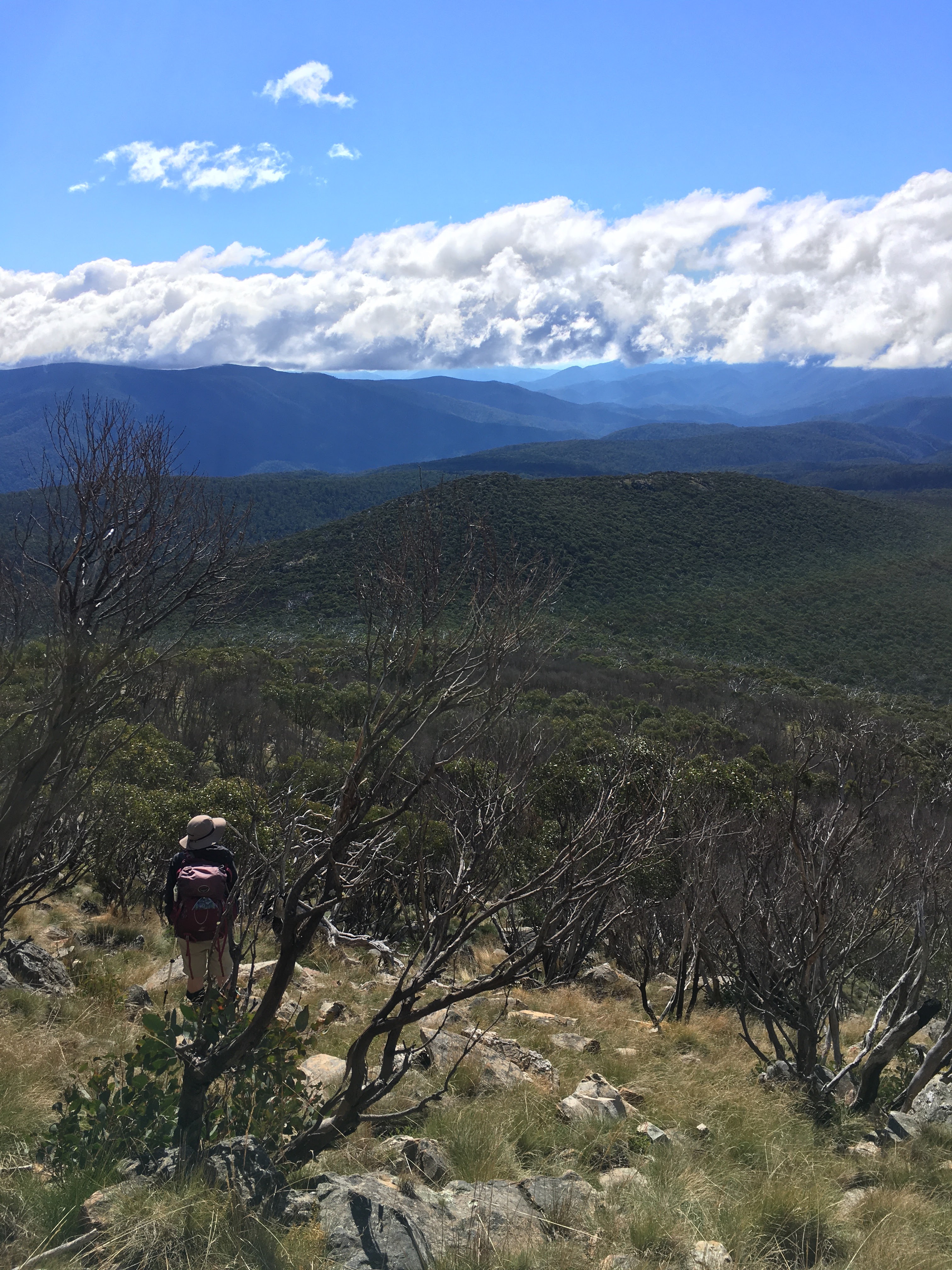
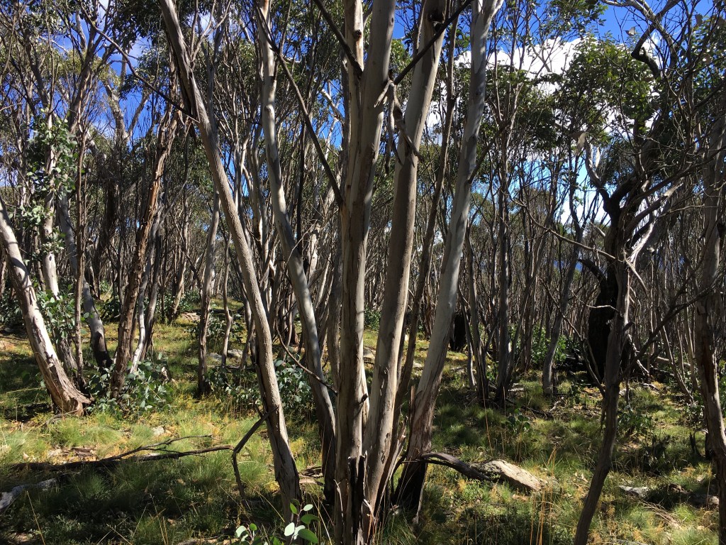
What we weren’t expecting were the rocks – among the open woodland, disguised among the grasses, the footing was almost always small boulders of the ankle-breaking type. We tried different tracks up the slope; tried making for vegetation that looked different to see if we’d get away from the rocks, but on the route we’d chosen, they were persistent. This made a steep climb much, much harder, and half way up I started worrying about the descent. Thank goodness for hiking poles – proving themselves on their maiden trip!

I was pretty knackered by the time we reached the top, with a persistent sore knee, but whatever my mood, it was nothing that lunch with a view couldn’t fix!

At the summit of The Pilot. – looking west.

We could see the clearing of Cowombat Flat to the south; the ridge of the Main Range to the north. I spent ages with the map trying to make sense of the land to the east. From the Main Range to the Snowy, long ridges overlap, fading in and out of one another, hazy with eucalypt green and distance. We pondered the fall of the land towards the Snowy, and thought about our walk out over the next few days.

Again, it’s not until later that I read John Blay’s description – it helps make sense of the view from The Pilot:

This is one of very few stand-alone peaks in the region. Vistas lie in all directions. Even Kosciuszko looks impressive. The sense of the Ingeegoodbee running along a high, limitless plateau when you’re by the river is put into its true perspective when it is shown to be a fool’s paradise, for in actual fact the land soon enough falls away savagely from either side. The drop off to the Murray is also very, very dramatic. Southwards, only a few kilometres away across Cowombat Flat, the peaks of the Cobberas are rugged and stony and unforgettable … The line of mountains blocking the south-eastern Monaro makes better sense of the lay of the distant land than I have found anywhere else … The countryside is laid out more clearly for me than if it were signposted on a map.

John Blay, On Track: Searching out the Bundian Way (2015)

At some point, up there on the mountain, R pointed out that this is not a mountain many people climb, given it’s a two-day walk from the nearest road access. It was only later that I thought about how lucky we really were on that day – not just to climb a mountain and see a spectacular view of an incredible landscape, but simply to be there at all.

The descent was much easier – R found a better route that wasn’t quite as rocky, and we took our time.

On the way back to Tin Mine Huts, we get talking about why we hike. For me, it’s bound up in walking of all sorts, which led us to talking about Wanderers: A history of women walking (Kerri Andrews, 2020) which I’d read not long previously. It features ten women from the last three hundred years who walked far more than was socially acceptable for their time or place, and who hadn’t only walked to get somewhere, but for the sake of walking itself. They had written about it, reflected upon it, and for all of them the act of walking was integrally connected to who they were, how they lived or to their creativity.

So why do I hike, and particularly, multi-day hikes? That night in my tent I wrote:

  • for those moments of the sublime or spectacular
  • for the satisfaction afterwards – the achievement of a goal
  • to be in nature
  • for the sake of walking – walking that gets to go on and onwards, and doesn’t bring you back to civilisation the same day
  • for the big memories in life – hiking gives me a touchstone by which to remember a season, a year, a place, a time in my life.

There’s other motivations, too, harder to articulate than the quick list I wrote that night. Balancing the motivations there are also hesitations, questions and the reality of daily life. But now, writing this many weeks later, there is no doubt that those six days from Cascade Trail to the Snowys has been a highlight of the year so far. As a long Canberra winter drags on, it’s impossible not to start dreaming of the next hiking adventure!

Next: The Ingeegoodbee and the Nine Mile Pinch

Tin Mine Falls (The Pilot and the Pinch Part II)

Many of the joys of hiking are small surprises: brightly coloured fungi; a dramatically curved tree; food tasting so much better outside; a group of seven flame robins around the fireplace on a grey morning. Then there are wonders that are spectacular but not unexpected: views from a mountaintop, night skies, sunrises.

Then once in a while there is something utterly unexpected and breathtaking.

Day 3 is meant to be a quiet day: we spend the morning sheltering out of the rain at Tin Mine Huts. We finish reading the newspaper that we’d brought along for kindling, and Rachel does the crossword. After lunch the rain eases, and we decide we’d better make the most of the afternoon, cold and grey as it is. So with raincoats, safety gear and muesli bars, we set off back up the track to see if we can find Tin Mine Falls. Our expectations aren’t high – we might not find the track, or might not get as far as the falls.

Crossing Tin Mine Creek

Following the instructions in the Australian Alps Walking Track book (5th ed., 2021), we locate a suggestion of a track leading west from Cascade Trail 2.7km north of the huts. The first suggestion was a false start; the second much clearer, leading into fairly dense bush. We spot flagging tape at intervals – someone has made this walk much easier by flagging trees along the way. These lead us down a steep descent to where a fallen branch provides a bridge of sorts across the narrow but fast-flowing Tin Mine Creek creek.

We bush-bash up the other side, among ash trunks glistening cream and pink in the rain, and onto a ridge where the vegetation grows drier and the ground is rocky. Here there are thickets of burnt saplings, and we lose the trail for a while. We plunge into the head of a densely vegetated gully, still heading west, before re-locating the flags and turning right, walking around the side of a steep hill. The walk is beautiful, but at times a little unnerving – despite knowing how to navigate, carrying maps and a compass and with a GPS tracking our route, and despite the flags. Walking off track is a rare experience for me – last time was in the Boranup Forest near Margaret River – and it carries with it a new sense of vulnerability to the enormity of the landscape.

We know that in theory we should emerge on a ridge from where we can see the falls. We come through thinning trees on a grassy spur, and as the ground begins to fall away, suddenly the view is before us.

A deep, steep valley, surrounded by rugged mountain ranges half-hidden in rain and cloud. It is dramatic and breathtaking – helped by the gloom of the weather and our sense of exposure on a rocky outcrop in the wind, with this incredible drop beneath us.

We can hear the falls over the wind before we see them – they are tucked away to our right far below. Although they drop 120m, pouring out of a valley we can’t see and plunging down among the rocks and trees, they are dwarfed by the mountains all around them. It’s hard to believe those falls are from the same creek we climbed across earlier. In many places the trunks of the trees are clearly visible on the mountain sides opposite – so steep are the slopes that there is no opportunity for a dense canopy here. Higher up, the silver skeletons of long-burnt trees tower over the canopy of younger ash.

Later, I read an account by John Blay, naturalist, walker and writer. Approaching from another angle, he writes:

A lyrebird scrambles away in alpine ash. Then suddenly there is the edge, a gut-wrenching view down into the Murray River, like a hole at my feet. The clouds lift as I cut around the clifftops above the remarkable canyon of the Tin Mine Creek. Rock faces show where shale has been sheared to a depth of hundreds of metres. Some great distance below me the falls begin their drop of a clear 120 metres in veils of droplets and shifting rainbows to rainforest far below. This one vision says so much about where I am, what a perilous plateau I’ve attained and how far down it is to go back to the reality of the lowlands. Spiderflowers pepper the slopes with crimson dots. Stepping lightly on the way back I find parsons band orchids and rose quartz. The stone underfoot is often coloured with the glint of minerals. The silvery blue leaf forms of spinning gum excite me.

John Blay, On Track: Searching out the Bundian Way (2015)

I hadn’t comprehended, when we stood there above the falls, that we were looking at a fall into the Murray River. From its beginnings to the south at Cowombat Flat (which I’m yet to visit), it’s hard to comprehend the dramatic curve of the river that brings it back to so near here, flowing north towards the great ranges that rise ahead, yet already moving down, beginning its long, interrupted pathway towards the slopes and plains to the west.

And Blay’s words stick with me: what a perilous plateau I’ve attained and how far down it is to go back to the reality of the lowlands. We are here in the mountains so briefly, R and I. Rather than perilous, it feels unreal, but there is no doubting how very far away the lowlands are.

I look back one last time before we walk away, into this dramatic distance.

Next: The Pilot

The Pilot and the Pinch: Six days on foot from Cascade Trail to the Snowy (Part 1)

It’s mid-April, and getting cold in the Snowy Mountains. Rachel and I set out from Dead Horse Gap on a blue-sky Easter Sunday, sharing the trail with hikers and cyclists, but by late afternoon the next day everyone else has gone. For four of our six days on the trail, we don’t see anyone else. It’s just us and our packs (which become as essential and familiar as dear friends!) in the bush with the wildlife.

Looking back, the first few kilometres are a blur: busy, workaday me still hanging around in my head even as my feet are carrying me into the wilderness. That first afternoon I can’t quite focus on my surroundings; we chat, which takes my mind off the first big hill, but an anxious inner monologue plays alongside.

It’s a short enough first day – less than 10km – along the Cascade Trail to Cascades Hut. We share the spot with four others, who have the fire going in the outside fireplace and, as is so often the way on the trail, we swap stories for a while over cups of tea and hot chocolate.

Camping at Cascades Hut

After dark, our world narrows to the circle of firelight and the beam of a headtorch.

I sleep well, thanks to a new sleeping mat and warm bag, and get up in the early hours to a starry sky. The small, contained world of the evening is transformed, expansive and shadowy in the moonlight.

But it is emerging from my tent in the morning that makes me feel I’ve really arrived here, in this other world so far from daily life. There’s a pink dawn and the gentle light over the grassy banks of Cascade Creek. I’m finally here. Really here, in the bush, in the mountain air, far away from the working world, and excited for the days ahead.

Continue reading